Colonization has always been made possible through the means and technologies that cohere the incoherent, forcing the plates of scattered landscapes to merge and collapse into one. The sovereign’s favorite image is reflected in the small models of claimed territories produced by expeditionaries. Survey and cartography have been prerequisites for organizing any occupation operation.
3D-modeled maps introduce a third axis: vertical measurement. The terrain is rendered in a more “accurate” way. These maps invite the viewer to look diagonally or even horizontally—an added feature to 2D maps, which only enable the bird’s-eye view. The machine calculates the third axis and extrapolates the 3D shape.
The same principle applies to audio visualization: one needs time, frequency, and volume—three elements sufficient for mapping out a form, three distinct variables that can turn almost anything into computer-generated mass. Audible memory has a more subtle effect on the sense of belonging and ownership: melodies that sonically dominate the ears, landscapes that visually govern the eyes.
This project engages with forms that have been ideologically used and instrumentalized, yet still need to be challenged and subverted. That means toying with means that seem fully absorbed by the propaganda apparatus but must be reclaimed and decolonized.
Lower Upwards Horizon reclaims these formats to speculate on futures that accommodate imaginative landscapes—those that have not been occupied and never will be. Imagining a future not ruled by capitalism and modernism requires surpassing fictional narratives that merely project and repeat themselves; such a future cannot be positively articulated, but will emerge negatively.
- On The Fringes Of Hostility, September 2023
- Lower Upwards Horizon, March 2020
- Earth Unmute, Feb 2020
- Lower Upwards Horizon, July 2018
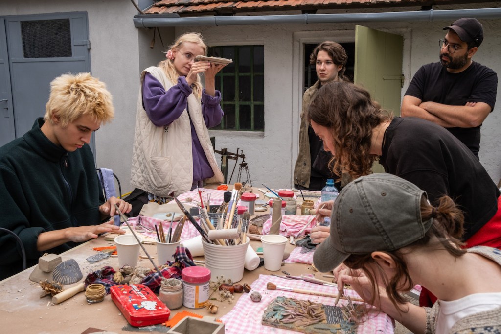
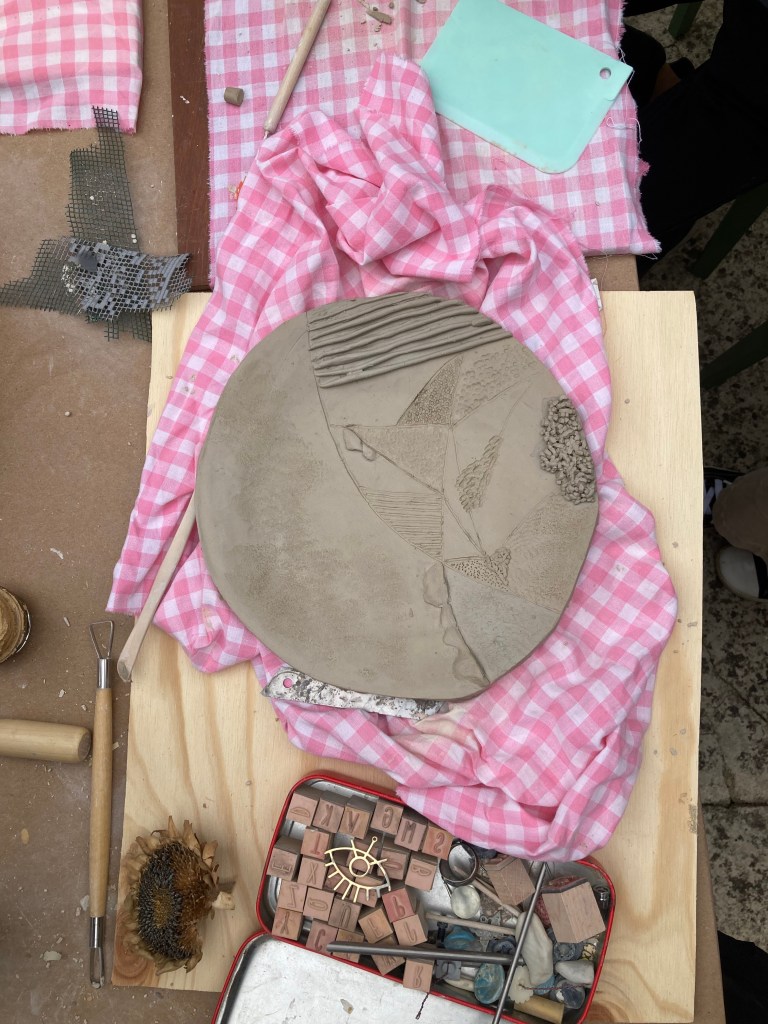
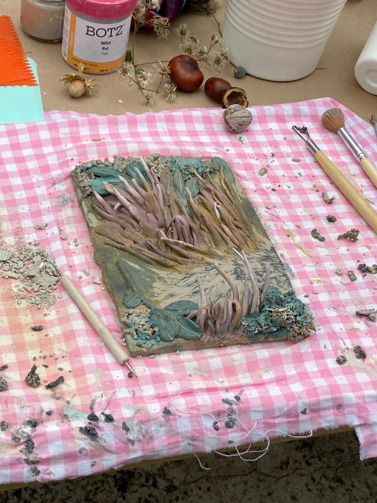
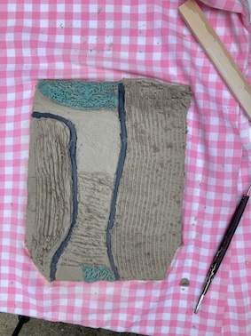
On The Fringes Of Hostility, September 2023
Workshop held together with Lunio hosted by AIR InSILo, Hollabrunn
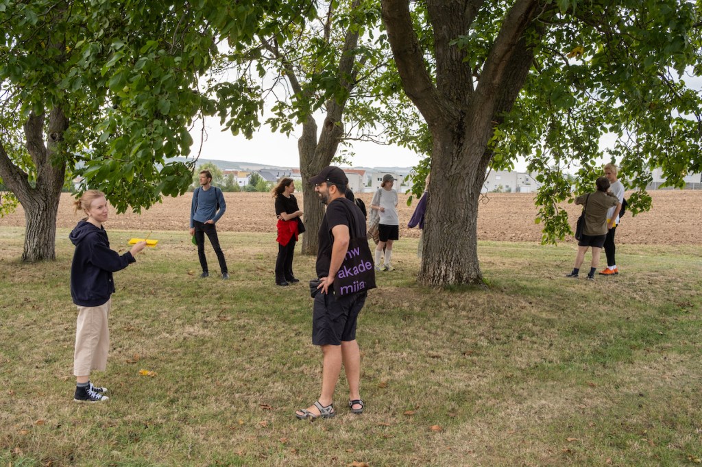
As opposed to the aerial imagery that flattens the height and consequently renders the map upon distance-demolishing technology which ignores the slow traversing of the rugged terrain by humans the workshop offers an investigation from below, where a particular yet haptic and tangible access to the land is possible.
through multiple pauses on the way drawing, looking, listening, etc, the senses are evoked to carefully engage with surroundings on a slow pace, studying the morphology and texture of the earth and land-partition methods.
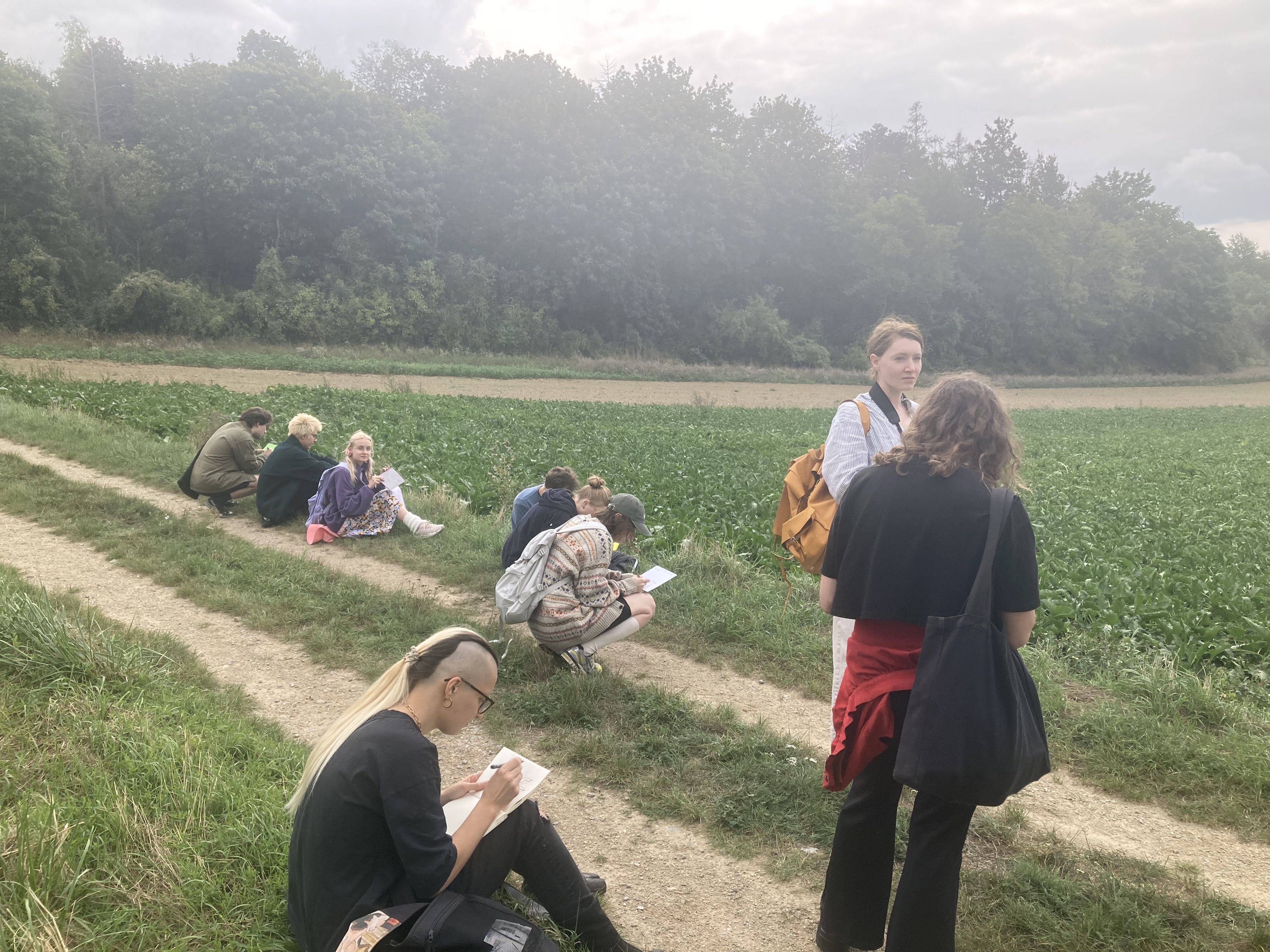
Besides that Aria and Lunio invited participants to observe the elements of creeping urbanization in the town of Hollabrunn, Lower Austria, and then to translate the ideas, problems, observations, and proposals into clay.
To engage with questions such as:
Does the land belong to the private sector? Is it open to the public? Is it only treated to serve human needs? Does the land have an agency, and how do all these alter literally and change the morphology and texture of the surface of the earth? Is it asphalted, cultivated (exploited), trimmed, etc?

Lower Upwards Horizon, March 2020
2 channel video, 3′ 50″
In Collaboration with Patrick Peljhan
Using satellite imagery, mapping and 3D-rendering tools, we are diagnosing the moments of simplification by examining the principles which lead to the “scientific image”. While framed as “science”, based on the humanist idea of the enlightenment, such technologies often are funded by the military-industrial complex. The fact that a lot of the programs and imagery we were using, are publicly accessible as “open-source” or “freeware” in the internet, developed by students as we are, applying their knowledge to research institutes set up within universities, further illustrates the imperialist network of academic, economic and military expansion.
Earth Unmute, Feb 2020
Music Score
performed by group Aponi “former”
If we consider geological time-frame, outside human sensory detection, earthquake is the event which happens on a scale that makes it audible and thus perceptible. this score is an attempt to give five performers the speculative play-ground, each performer to be analogous to one earth-layer.
the y axis represents space, as an indicator for sound-space, an item which assumes that sound occupies space ranging from different intensities and positions.
the x axis is time, the whole piece lasts 4 minutes. the drastic shift happens at 2:10, the moment which has to create the later refractions.
the z axis is standing for the imbalance of time and space. the movement occurs on the third axis.
the diagram should be read from left to right, each performer chooses one layer which is divided by shades of crosshatches. the negative spaces are representing the absence of the space, which can be interpreted as silence or whatever that stays distinct from the sculpted volumes. each layer remains more or less consistent, meaning each performer decides upon which kind of sound-texture has to be inscribed to the regarding layer and then commit oneself to keep it consistent throughout the piece.
Lower Upwards Horizon, July 2018
Group Exhibition at Zefak Ida Green
In Collaboration with Patrick Peljhan
Aluminium mesh, projector, speakers, sound loop
Light projection from the ceiling to the floor
crossing wave landscape mesh
hanging in median level of the room
creating a framed enlightened area on the ground
the projection on the floor
interrupted by the shape of the mesh
fences in a 2-dimensional distorted shadow map
On the ground level a stereo sound composition circles the space in a loop consisting of an layered humming
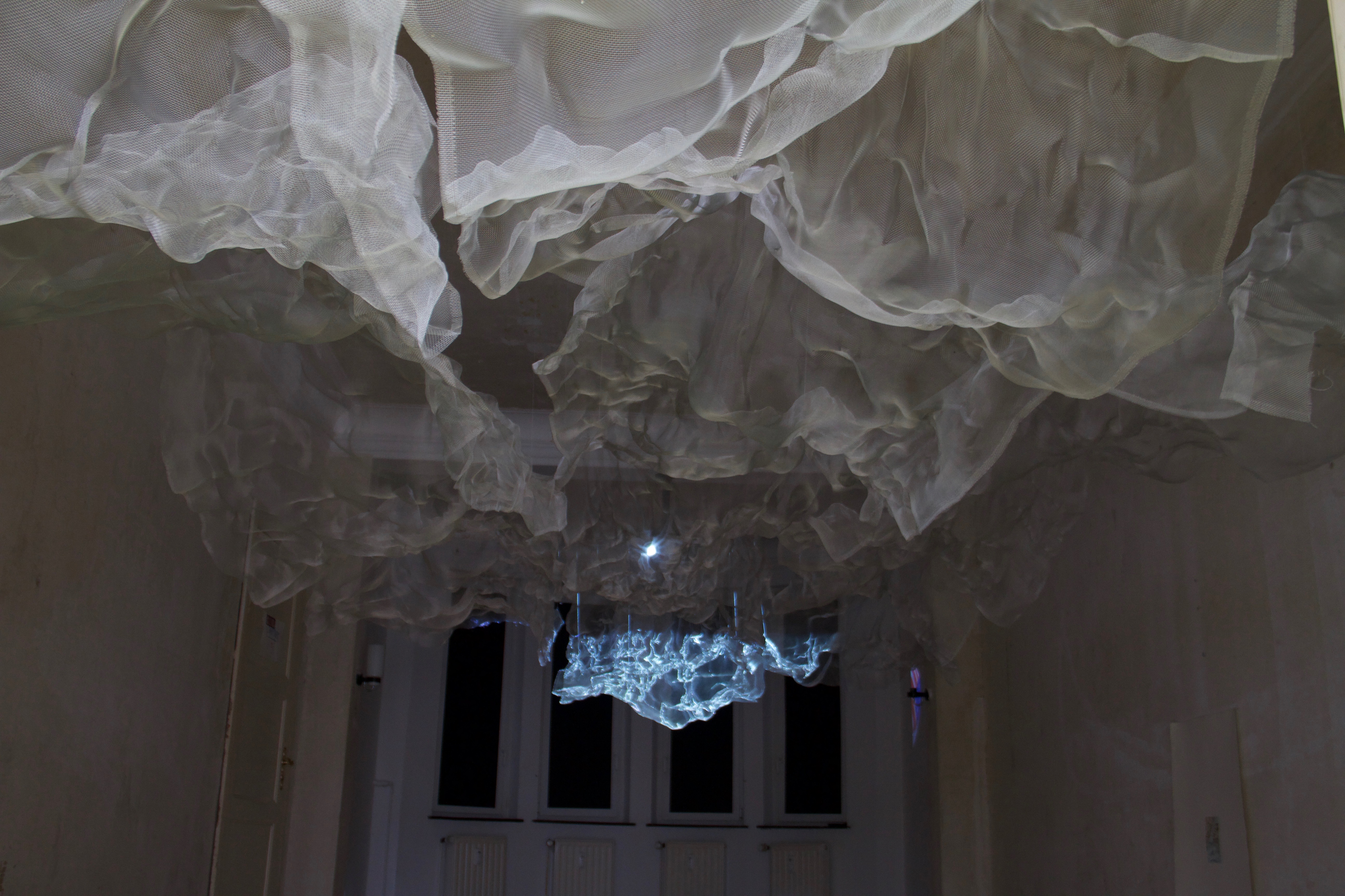


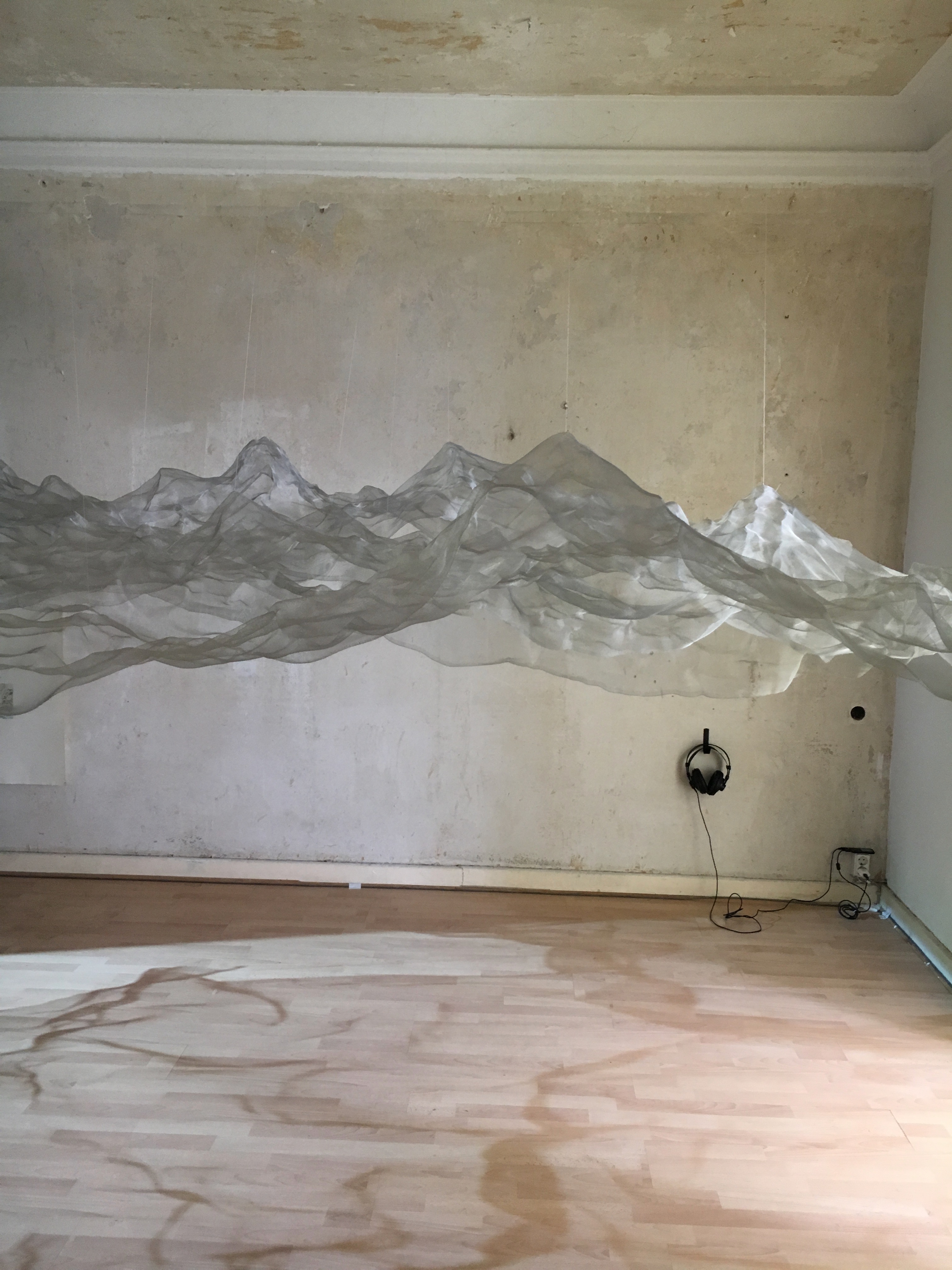
Aria Farajnezhad and Patrick Peljhan, Toppled from the Horizontal Axis, 2018. Exhibition view Navigate, Zefak Ida Green, 2018. Photo: Patrick Peljhan
